Preliminary program
Day 1 – December 12, 2007
08.00 -- Registration
09.15 -- Opening session – chair: Peter
van Oosterom - location: Senaatszaal
Keynote speech I
Rob van Essen, Vice President Strategic Research and Development, TeleAtlas
Maps Get Real, Digital Maps evolving from mathematical line graphs to
virtual reality models
10.30 -- coffee break
11.00 -- Presentation & Discussion session 1 -
chair: Andrew Frank - location: Senaatzaal
Requirements and Applications I
Navigable Space in 3D City Models for Pedestrians
Aidan Slingsby and Jonathan Raper – City University London
Towards 3D Spatial Data Infrastructures (3D-SDI) based on Open Standards
– experiences, results and future issues
Jens Basanow, Pascal Neis, Steffen Neubauer, Arne Schilling and Alexander
Zipf – University of Applied Sciences FH Mainz
Re-using laser scanner data in applications on 3D topography
Sander Oude Elberink – ITC Enschede
12.30 -- lunch break
13.30 -- Working Groups session 1
15.00 -- coffee break
15.30 -- Presentation & Discussion session 2 – chair:
Chirs Gold - location: Senaatzaal
Modelling I
First implementation results and open issues on the Poincaré-TEN
data structure
Friso Penninga and Peter van Oosterom – Delft University of Technology
Drainage reality in terrains with higher-order Delaunay triangulations
Ahmad Biniaz and Gholamhossein Dastghaibyfard – Shiraz University
Surface Reconstruction from Contour Lines by Least Squared-error Approximation
using Tensor-Product Cubic B-splines
Shyamalee Mukherji – Indian Institute of Technology
17.00 -- end
17.15 -- departure to city hall
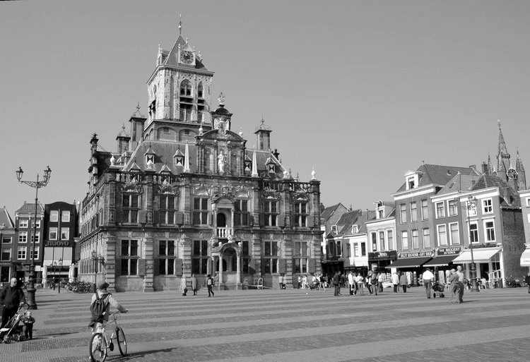
17.30 -- reception event in Delft city hall
Day 2 – December 13, 2007
09.00 -- Presentation & Discussion session 3 -
chair:: George Vosselman - location: Senaatzaal
Acquisition
Using 3D Laserscanners and Image Recognition for Volume-based Single-Tree-Delineation
and –Parametrization for 3D-GIS-Applications
Jürgen Rossmann and Arno Bücken – RWTH Aachen
Automatic building modeling from terrestrial laser scanning
Shi Pu – ITC Enschede
3D City Modelling from LIDAR data
Rebecca Tse, Christopher Gold and Dave Kidner – University of Glamorgan
10.30 -- coffee break
11.00 -- Working Groups session 2
12.30 -- lunch break
13.30 -- Presentation & Discussion session 4 -
chair: Marc van Kreveld - location: Senaatszaal
Visualisation
Techniques for Generalizing Building Geometry of Complex Virtual 3D
City Models
Tassilo Glander and Jürgen Döllner – University of Potsdam
Automatic Generation of Residential Areas using Geo-Demographics
Paul Richmond and Daniela Romano – University of Sheffield
Additional presentation:
Using 3D Open Web Services for a better collaborative response to disaster
management
Alain Lapierre, Paul Cote and Stéphane Côté –
Bentley Systems
15.00 -- coffee break
15.30 -- Presentation & Discussion session 5 - chair:
Peter Woodsford - location: Senaatszaal
Modelling II
Modeling and Managing Topology in 3D Geoinformation Systems
Adreas Thomsen , Martin Breunig, Edgar Butwilowski and Björn Broscheit
– University of Osnabrück
Mathematically provable correct implementation of integrated 2D and
3D representations
Rodney Thompson and Peter van Oosterom – Delft University of Technology
3D Solids and Their Management in DBMS
Chen Tet Khuan and Alias Abdul-Rahman – Universiti Teknologi Malaysia
Implementation alternatives for a 3D Integrated Model
Ludvig Emgard and Sisi Zlatanova – Delft University of Technology
17.30 -- end
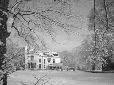
18.30 -- Conference dinner at country estate 'Te Werve', Rijswijk
Day 3 – December 14, 2007
09.30 -- Presentation & Discussion session 6 - chair:
Jonathan Raper - location: Senaatszaal
Requirements & Applications II
Using Raster DTM for Dike Modelling
Tobias Krüger and Gotthard Meinel – Leibniz Institut für
ökologische Raumentwicklung
Development of a Web Geological Feature Server (WGFS) for sharing
and querying of 3D objects
Jacynthe Pouliot, Thierry Badard, Etienne Desgagné, Karine Bédard
and Vincent Thomas– Laval University
10.30 -- coffee break
11.00 -- Presentation & Discussion session 7 - chair
Analysis
Serving CityGML via Web Feature Services in the OGC Web Services –
Phase 4 Testbed
Eddie Curtis – Snowflake Software
Towards space-based modelling of continuous spatial phenomena: example
of noise
Jantien Stoter, Henk de Kluijver and Vinaykumar Kurakula – ITC Enschede
The Kinetic 3D Voronoi Diagram: A Tool for Simulating Environmental Processes
Hugo Ledoux – Delft University of Technology
12.30 -- lunch break
13.30 -- Keynote speech II: "On Valid and Invalid Three-Dimensional
Geometries"
Baris M. Kazar, Ravi Kothuri, Peter van Oosterom and Siva Ravada
14.30 -- coffee break
15.00 -- Closing session – chair
Working group presentations
17.00 -- end
Working groups
WG I Requirements & Applications
chair Andrew Frank – TU Wien
WG II Acquisition
chair George Vosselman – ITC Enschede
WG III Modelling
chair Chris Gold - Glamorgan University
WG IV Analysis
chair Jiyeong Lee - University of Seoul, South Korea
WG V Visualisation
chair Marc van Kreveld - Utrecht University