Martijn Meijers
About Me
dr.ir. B.M. (Martijn) Meijers
Martijn (1981) started his studies in Geodesy and Cartography at Utrecht University of Professional Education (Hogeschool van Utrecht), where he specialised in Geographic Information Systems. He continued his studies at Delft University of Technology, where he obtained a Master of Science degree in Geomatics in 2006. In 2011, he successfully defended his PhD thesis at this university on the topic of Variable-scale Geo-information.
Currently, he is employed as a Postdoc Researcher at Delft University of Technology, Department of GIS technology. Martijns research interests include geo-database management systems, map generalisation, cartography and geo-visualization, (applied) computational geometry for GIS, handling large datasets and topological consistency.

Publications
2015
- Parallel creation of vario-scale data structures for large datasets ISPRS - International Archives of the Photogrammetry, Remote Sensing and Spatial Information Sciences XL-4/W7 pp. 1–9 2015 Presented at 4th ISPRS International Workshop on Web Mapping and Geoprocessing Services, 01 – 03 July 2015, Sardinia, Italy doi pdf
- The Potential of the 3D Dual Half-Edge (DHE) Data Structure for integrated 2D-Space and Scale Modelling: a Review Presentation at 3D GeoInfo, Kuala Lumpur, Malaysia, 28 - 30 October 2015 October 2015
- Large Scale Road Network Generalization for Vario-scale Map Proceedings of the 18th ICA Workshop on Generalisation and Multiple Representation, State University of Rio de Janeiro, Rio de Janeiro, Brazil August 2015 pdf
2014
- A triangulation-based approach to automatically repair GIS polygons Computers & Geosciences 66 pp. 121–131 2014 Available online 30 January 2014 doi pdf
- Vario-scale data structures supporting smooth zoom and progressive transfer of 2D and 3D data International Journal of Geographical Information Science 28 3 pp. 455–478 2014 doi pdf
- A Voronoi-based approach to generating depth-contours for hydrographic charts Marine Geodesy: an international journal of ocean surveys, mapping and sensing 37 pp. 145–166 2014 doi pdf
- Abstracting geographic information in a data rich world: Methodologies and applications of map generalisation Lecture Notes in Geoinformation and Cartography 2014 XV Dirk Burghardt, Cécile Duchene, William Mackaness (editors) Data Structures for Continuous Generalisation: tGAP and SSC Springer pp. 83–118 2014 Chapter 4 in Book "Abstracting geographic information in a data rich world" doi pdf
- An area merge operation for smooth zooming Connecting a Digital Europe Through Location and Place Lecture Notes in Geoinformation and Cartography Joaquín Huerta, Sven Schade, Carlos Granell (editors) pp. 275–293 2014 doi
- Continuous road network generalisation Proceedings of the 17th ICA Workshop on Generalisation and Multiple Representation, Vienna, Austria, September 23, 2014 2014
2013
- 3D visualisation of underground pipelines: best strategy for 3D scene creation ISPRS Annals of Photogrammetry, Remote Sensing and Spatial Information Sciences II-2/W1 pp. 139–145 2013 doi pdf
- A star-based data structure to store efficiently 3D topography in a database Geo-spatial Information Science 16 4 pp. 256–266 2013 doi pdf
- Representing three-dimensional topography in a DBMS with a star-based data structure Progress and New Trends in 3D Geoinformation Sciences Lecture Notes in Geoinformation and Cartography Jacynthe Pouliot, Sylvie Daniel, Frédéric Hubert, Alborz Zamyadi (editors) Springer Berlin Heidelberg 978-3-642-29793-9 pp. 119–132 2013 doi pdf
- SplitArea: een algoritme om vlakken te splitsen voor de tGAP data structuren Geo-Info 10 3 Geo-Informatie Nederland 1572-5464 (print) 2211-0739 (online) pp. 14–18 2013 pdf
- 2D vario-scale representations based on real 3D structure Proceedings of the 16th ICA Generalization Workshop pp. 1–11 August 2013 pdf
- EdgeCrack: a parallel Divide-and-Conquer algorithm for building a topological data structure Urban and Regional Data Management: Annual 2013 Claire Ellul, Sisi Zlatanova, Massimo Rumor, Robert Laurini (editors) CRC Press pp. 107–116 May 2013 pdf
- Generation and generalization of safe depth-contours for hydrographic charts using a surface-based approach Proceedings of the 16th ICA Generalization Workshop pp. 1–9 August 2013 pdf
2012
- Validation and Automatic Repair of Planar Partitions Using a Constrained triangulation Photogrammetrie, Fernerkundung, Geoinformation (PFG) 2012 5 1432-8364 pp. 613–630 November 2012 pdf
- Variabele-schaal geo-informatie Geo-Info 10 Geo-Informatie Nederland 1572-5464 (print) 2211-0739 (online) pp. 21–42 2012 pdf
- Een landsdekkende BGT, zonder gaten en overlap Geo-Info 8 Geo-Informatie Nederland 1572-5464 (print) 2211-0739 (online) pp. 4–8 2012 pdf
- Vario-scale data structures supporting smooth zoom and progressive transfer of 2D and 3D data Jaarverslag 2011 Nederlandse Commissie voor Geodesie 978-90-6132-338-9 pp. 21–42 2012 pdf pdf
- Vario-scale data structures for 2D and 3D geo-information ISG 2012: Proceedings of the 11th International Symposium & Exhibition on Geoinformation Kuala Lumpur ISG pp. 1–19 2012 pdf
- Automatically repairing polygons and planar partitions with prepair and pprepair Proceedings of the 4th Open Source GIS UK Conference September 2012 Best paper/presentation award pdf
- Automatically repairing invalid polygons with a constrained triangulation Multidisciplinary Research on Geographical Information in Europe and Beyond. Proceedings of the 15th AGILE International Conference on Geographic Information Science Jérôme Gensel, Didier Josselin, Danny Vandenbroucke (editors) pp. 13–18 April 2012 pdf pdf Presentation
- Comparing the vario-scale approach with a discrete multi-representation based approach for automated generalisation of topographic data Proceedings of the 15th Workshop of the ICA Commission on Generalisation and Multiple Representation jointly organised with EuroSDR Commission 4 - Data Specifications Istanbul, Turkey pp. 1–10 September 2012 pdf
- True vario-scale maps that support smooth-zoom Proceedings of the Geospatial World Forum 2012 Amsterdam, The Netherlands pp. 1–9 April 2012 pdf
- Integrating scale and space in 3D city models Proceedings of the 7th International 3D GeoInfo Conference International Archives of Photogrammetry, Remote Sensing and Spatial Information Sciences XXXVIII-4/C26 Jacynthe Pouliot, Sylvie Daniel, Frédéric Hubert, Alborz Zamyadi (editors) pp. 7–10 May 2012 doi pdf pdf
- 5D modelling - applications and advantages Proceedings of the Geospatial World Forum 2012 Amsterdam, The Netherlands pp. 1–9 April 2012 pdf
2011
- Topologically consistent 3D city models obtained by extrusion International Journal of Geographical Information Science 25 4 pp. 557–574 2011 pdf
- Simultaneous & topologically-safe line simplification for a variable-scale planar partition Advancing Geoinformation Science for a Changing World Lecture Notes in Geoinformation and Cartography Stan Geertman, Wolfgang Reinhardt, Fred Toppen (editors) Springer Berlin Heidelberg pp. 337–358 April 2011 pdf
- Towards a true vario-scale structure supporting smooth-zoom Proceedings of 14th ICA/ISPRS Workshop on Generalisation and Multiple Representation Paris pp. 1–19 2011 pdf
- Cache-friendly progressive data streaming with variable-scale data structures Proceedings of 14th ICA/ISPRS Workshop on Generalisation and Multiple Representation pp. 1–19 2011 pdf
- The space-scale cube: An integrated model for 2D polygonal areas and scale 28th Urban Data Management Symposium International Archives of Photogrammetry, Remote Sensing and Spatial Information Sciences 38 4 pp. 95–102 September 2011 doi pdf
- Variable-scale Geo-information Delft University of Technology 978-9-6132-335-8 December 2011 pdf pdf pdf
- Method and system for generating maps in an n-dimensional space 2006630 2011 Dutch patent application 2006630, WO 2012/144983, filed April 19, 2011, published October 26, 2012. pdf
2010
- Validation of planar partitions using constrained triangulations Proceedings of the 14th Joint International Conference on Theory, Data Handling and Modelling in Geospatial Information Science Hong Kong pp. 51–56 May 2010 pdf
- Applying DLM and DCM concepts in a multi-scale data environment Proceedings of GDI 2010: Symposium on Generalization and Data Integration Barbara P. Buttenfield, Cynthia A. Brewer, Keith C. Clarke, M.P. Finn, E. Lynn Usery (editors) Boulder, USA University of Colorado pp. 1–7 2010 pdf
2009
- A storage and transfer efficient data structure for variable scale vector data Advances in GIScience Lecture Notes in Geoinformation and Cartography Monika Sester, Lars Bernard, Volker Paelke (editors) Springer Berlin Heidelberg 1863-2246 (print) 1863-2351 (online) 978-3-642-00318-9 pp. 345–367 2009 doi pdf
- Topologisch consistente 3D-stadsmodellen: een aanpak op basis van extrusie en triangulatie Geo-Info 6 12 Geo-Informatie Nederland 1572-5464 (print) 2211-0739 (online) pp. 8–12 2009 pdf pdf
- Extruding building footprints to create topologically consistent 3D city models Urban and Regional Data Management: Annual 2009 Alenka Krek, Massimo Rumor, Sisi Zlatanova, Elfriede M. Fendel (editors) CRC Press pp. 39–48 June 2009 pdf
- Applying DLM and DCM concepts in a multi-scale environment Dagstuhl Seminar Proceedings 'Generalization of Spatial Information (09161)' S. Mustière, M. Sester, F. van Harmelen, P. van Oosterom (editors) April 2009 pdf
- Research challenges in automated generalisation and cartographic modelling Proceedings of Think Tank meeting, Centre for Geospatial Science Nottingham, United Kingdom Ordnance Survey pp. 1–2 December 2009 pdf
2008
- A data model for multi-scale topographical data Headway in Spatial Data Handling: Proceedings of the 13th international symposium on Spatial Data Handling, SDH 2008 Lecture Notes in Geoinformaton and Cartography A. Ruas, C. Gold (editors) Berlin Springer 978-3-540-68565-4 pp. 233–254 2008 pdf
2007
- Considerations for the design of a semantic data model for a multi-representation topographical database Proceedings of the 2nd ISGI 2007: International CODATA symposium on generalization of information, Geneva, Switzerland, 1-3 October 2007 Lecture notes in Information Sciences H. Kremers (editor) Berlin CODATA 978-3-00-022382-2 pp. 53–71 October 2007 pdf
2006
- Vario-scale data server in a web service context Proceedings of the ICA Workshop on Map Generalisation and Multiple Representation Vancouver, USA pp. 1–14 June 2006 pdf
- Implementation and testing of variable scale topological data structures: experiences with the GAP-face tree and GAP-edge forest Delft University of Technology June 2006 pdf
2005
- 3D geo-information indoors: structuring for evacuation Proceedings of the First International Workshop on Next Generation 3D City Models Bonn, Germany pp. 1–6 June 2005 pdf
Other overviews
My publications, via:
- Metis (TU Delft publication system)
- GDMC
- Repository TU Delft
- Scopus
- Google Scholar
- DBLP
- Microsoft Academic Search
Education
Courses
Courses that I am (or have been) involved in:
- GEO3001 – Python Programming for Geomatics (MSc Geomatics, BK)
- GEO1010 – Python Programming for Geomatics (Minor Sensing the City, BK)
- SPM2710 – Ruimtelijke plannen en ruimtelijke modellen (BSc, TBM)
- GM1050 – GIS Principles and Applications (MSc, Geomatics)
- GE4612 – Geo-information Infrastructure Technology (MSc, Geomatics)
- CT1130 – Geo-informatie voor Civiel Technici (BSc, CiTG)
MSc graduates
MSc thesis research, in which I was involved:
- Dimitrios Zervakis (2015), MSc thesis
- Ravi Peters (2012), MSc thesis
- Josafat Isaí Guerrero Iñiguez (2012), MSc thesis
- Ken Arroyo Ohori (2010), MSc thesis
Related study
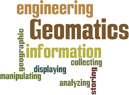
Geomatics is concerned with collecting, storing, manipulating, analyzing, and displaying information about geographic phenomena.
Software
Python gems

My Python gems are hosted on Bitbucket. Version Control: https://bitbucket.org/bmmeijers/.
prepair
prepair, Automatic repair of single polygons (C++). Maintained by: Ken Arroyo Ohori & Hugo Ledoux. Version Control: https://github.com/tudelft3d/prepair.
pprepair
pprepair, validation and automatic repair of planar partitions (C++). Maintained by: Ken Arroyo Ohori. Version Control: https://github.com/tudelft3d/pprepair.
Elsewhere
Contact information
Contacting me
Either via e-mail:
b.m.meijers@tudelft.nl,
or via phone: +31 (0) 15 278 56 42.
Visiting me
TU Delft
Faculty of Architecture and the Built Environment (Building 8)
Department of GIS technology
Julianalaan 134, 2628 BL Delft, The Netherlands
Office 00.west.510 (monday–friday)